 LU konference
A 3D visualization of Kazu Leja geological model
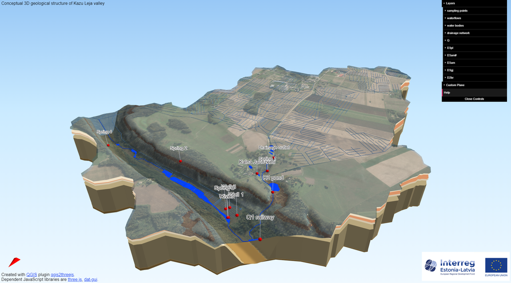
A three dimensional interactive visualization of the Kazu Leja sites was elaborated within the GroundEco project. The visualization was based on WebGL un three.js JavaScript libraries. The visualization represents a simplified geological structure and surface topography of Kazu Leja valley.
The model covers the surface catchment area of the small river Triečupīte that emerges from the Kazu Leja. Topographicaly Kazu Leja is about 3 km long and 1 km wide almost 50 mm deep valley-like depression connecting the modern valleys of Gauja and Vaive rivers. The modern valley follows a partly buried paleo incision, that is filled with glacial sediments. It is the paleo incision cuts in to clastic sediments of Burtnieki and Gauaj formation of middle Devonian as well as clastic sediments of Amata formation and dolomites of Pļaviņas formation of Upper Devonian.
The model visualisation is available here (131 MB – could take some time to load).